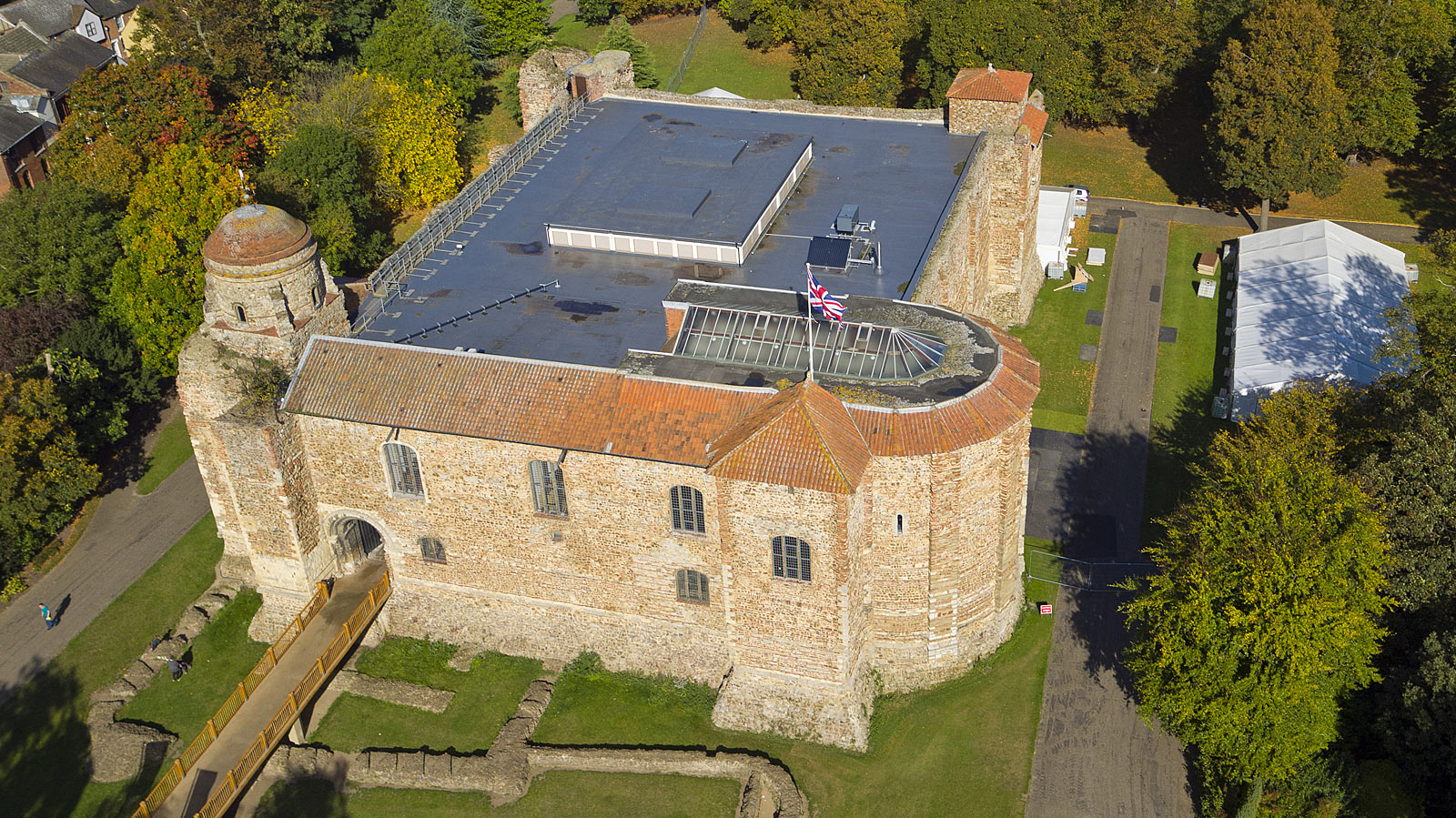
Aerial survey isn't a new technology, but in the past it has mostly been carried out by expensive manned aircraft with all the associated limitations. Who, for instance, could imagine hiring a helicopter to inspect the lead flashing on the roof of your apartment block. If nothing else, the neighbours and authorities might have something to say about the noise, disturbance and risks.
A drone, on the other hand, can literally go where no aircraft has gone before and film or photograph in much greater detail, as the images on this page show. Drones are much more cost effective than any of the alternatives, scaffolding, lift platforms, towers etc., and also a lot quicker and safer. The disturbance element is also considerably less using a modern sophisticated camera drone, with the average detailed survey taking less than two hours with virtually no noise or inconvenience.
beda:photo
Birch House
Orpen's Hill, Birch, Essex, UK CO2 0LY
+44(0)1206 912016
info@bedaphoto.com
Professional, high resolution images • CAA approved pilots
Photos taken from above are generally far more informative and can show the general condition, style and location of a building far more effectively.
Using a drone is quick and cost effective• Minimal disturbance
A camera drone can get to areas previously inaccessible without expensive specialist equipment or the time, money and manpower needed to erect complex scaffolding.
See every detail quickly and easily• Minimal cost – maximum effectiveness
With information like this it's much easier to make decisions about maintenance requirements, expenditure and scheduling, within minutes if necessary.
Famous landmarks from above.• They look very different
Because of its sheer size, there is no better way of viewing the whole of Colchester Castle than from the air.
Get as close as you like to inspect every detail of the building's condition
Aerial surveys, inspectionsAs much close up detail as you want for survey or sales purposes
Aerial photography, video, surveysAerial photography shows the scope and design like no other medium
Aerial photography, video, surveysThe most informative way of showing off all aspects of a property to remote customers
Aerial photography, video, surveysAerial photography captures the scale & extent like no other medium, and close up detail if you need it.
Aerial photography, video, surveysLocation, setting, condition, detailed information on which to base spending decisions, it's all there.
Aerial photography, video, surveysHigh rooftops in densely populated areas are becoming increasingly common. Only drones can do this quickly and easily.
Aerial photography, video, surveysContact us to discuss your project and see how professional high resolution images, still or moving, can help solve your problem. It costs nothing to talk and we don't charge for estimates.